 |
|
|
|
|
|
|
|
|
|
|
|
|
Images to be used when the Katherine River is in
potential flood mode
Please refer to the Katherine Internet Start Page for flood information & links on the Katherine Flood
Putting the Katherine River into perspective via
satellite & good old Google Earth
(Larger than usual image files, approx 85-140kb each)
 |
Following the
Katherine River & located at the
Birdie Creek entrance point to the Katherine River is a Water gauge that
assists with recording flows from the Katherine Rivers upper reaches. This gauge is 90km above Katherine.
It then enters the Nitmiluk Gorge system and
comes out the other side to be recorded again with additional flows from 17
Mile creek During March 2007 a peak at Birdie Creek related to a peak at Nitmiluk 27ish hours later (in those conditions)
|
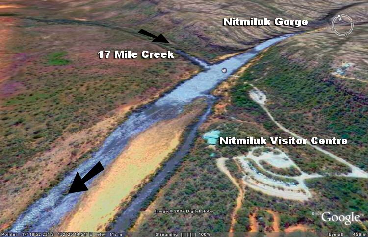 |
At the
Nitmiluk Katherine Gorge It flows out of the 13 Gorges of Nitmiluk Gorge system
17 Mile Creek also flows in off the Northern escarpment
Please note the image is only a rough representative of the actual Gorge |
 |
Water flowing
through Nitmiluk Centre gauge Distance approx 35km Along this stretch , there is McAddens creek, Maud Creek, 2 mile creek that feed the Katherine River. Also Tindal Creek that meets up with the Town Drain. |
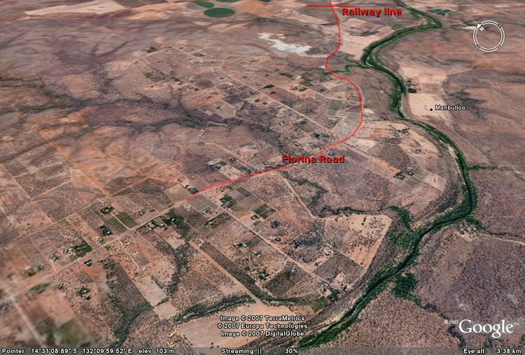 |
About 15 km
downstream of Katherine the river usually peaks 6-8 hours after the peak
at the Katherine Bridge. This is along Florina road. There are several creeks here that feed the
River. |
Return to Katherine Internet Start Page

